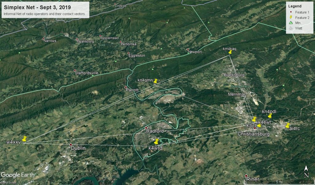
On September 3rd, there was an informal net communication that went out to the club email list. While this wasn’t an official club activity, I took interest in the information that was gathered and attempted to create a mapping of the contacts. Below is the resulting map image and a link to the Google Earth file if you would like to see for yourself. This took a small bit of programming and data manipulation to accomplish, and there is some big room for improvement. In particular I would like to represent the wattage used for the communication with different colors between stations. I also only took the location information from the FCC database, so if an operator was in a different location, that will not be represented on the map.

Click to download Google Earth Map (.kmz file)
I hope that this will show what is possible for developing information that we could use to understand our environment better!
73 de W4XXV
